Photo by Ben Gordon
Staunton Quarry
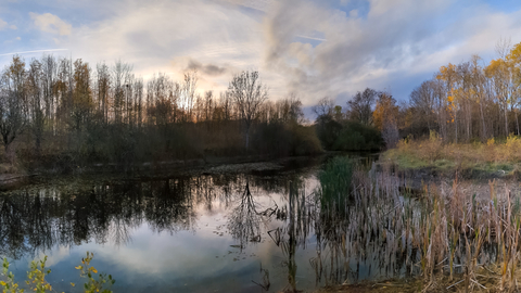
Staunton Quarry includes a well-vegetated water body, some grassland, planted poplars, and other broadleaved woodland.
Location
Know before you go
Dogs
When to visit
Opening times
Open all year roundBest time to visit
SummerAbout the reserve
This is one of Nottinghamshire Wildlife Trusts smaller nature reserves, with a total area of only 2.5ha. Furthermore, nearby Stonepit Plantation and Staunton Quarry are separated from each other by wildlife rich intervening land and are both barely larger than 1ha.
Staunton Quarry is unusual within Nottinghamshire, in being the only one entirely on strata of Liassic age. Furthermore, the calcareous nature of those rocks supports a flora that is not at all common in the county. Consequently, the flora includes species which are scarce locally, such as brookweed, fen pondweed and giant bellflower.


